Manual del usuario
Manual operativo de WildQuest AI para monitoreo de campo y conservación comunitaria: preparación del dispositivo, registro de observaciones, validación, respuesta a amenazas y casos implementados en Colombia.
Preparado por Environmental Women ORG · Documento original en inglés · Agosto 2026
Manual at a glance
Operational premise: We use WildQuest to convert field observations into community conservation decisions. The Tikuna-adapted protocol places Indigenous authority before data collection and returns monitoring results to collective decision-making after each field cycle.
| Section | What the reader learns |
|---|---|
| 1–3 | Purpose, Tikuna customary framework and the WildQuest information architecture. |
| 4–6 | Device preparation, field route planning and creation of conservation-grade observations. |
| 7–9 | Validation, threat response and the complete Tikuna field mission SOP. |
| 10–13 | Implemented species-conservation cases in the Amazon, Caribbean coast and Sierra Nevada. |
| 14–15 | Replication, monitoring, knowledge governance and a quick-reference field guide. |
This manual is written for field operation, training and technical review. It can be read sequentially by a new monitor or used by an experienced conservation team as a reference for a specific step. The implemented cases are not hypothetical exercises. They are drawn from conservation programs provided by Environmental Women ORG and from the user-defined history of WildQuest use since 2023.
1. Purpose, users and conservation scope
We use WildQuest AI as a field-to-decision system for species conservation. Since 2023, information generated through the application has informed species-specific conservation programs implemented or under implementation with Indigenous communities in Colombia. This manual explains how we operate that system in a way that can be understood by a community monitor in the Colombian Amazon and by a technical evaluator who has never seen our work. The operating sequence is simple: the community authorizes the field purpose, the team records biodiversity evidence, the platform structures the observation, the community interprets the result, and the conservation program converts that result into a practical response.
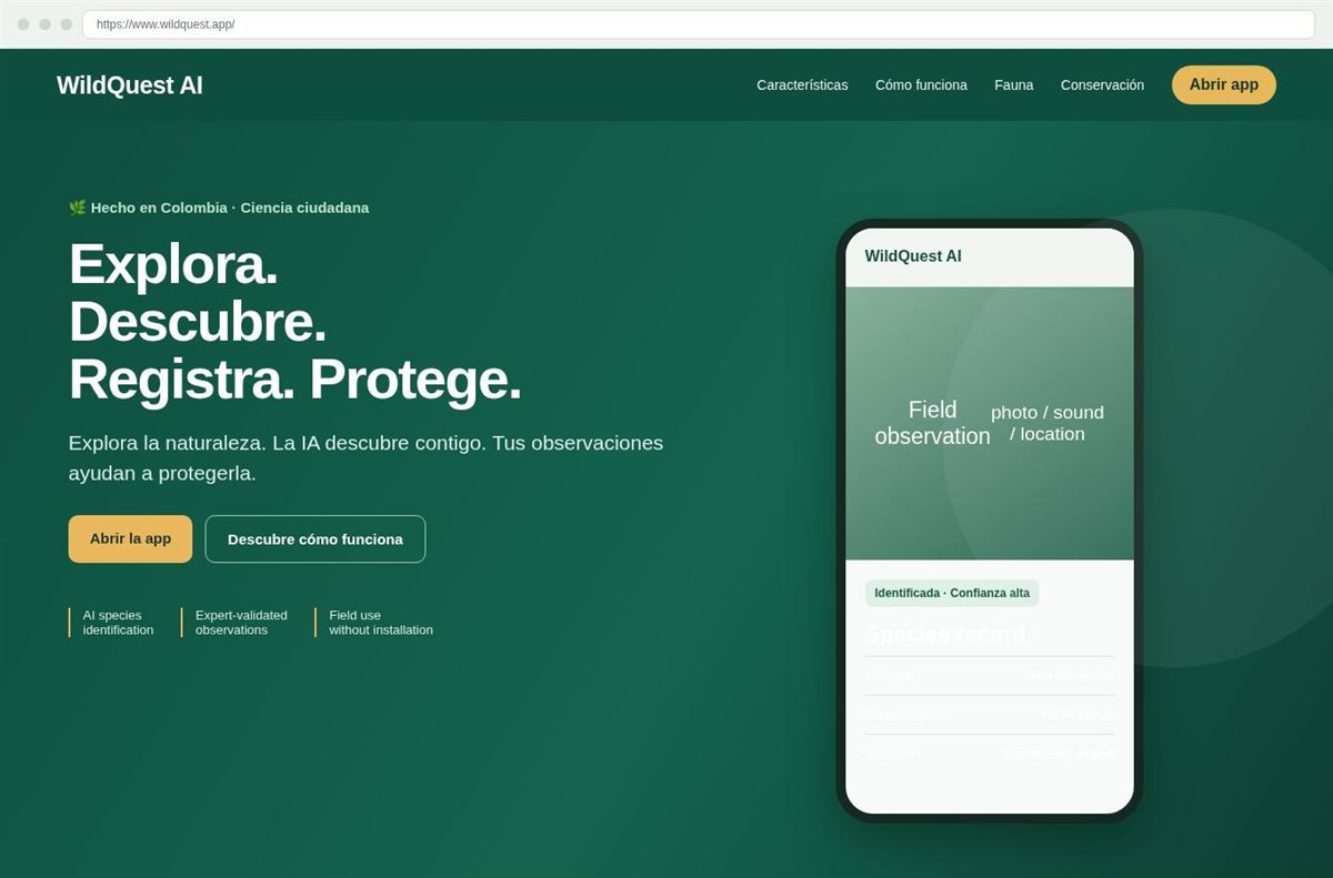
WildQuest AI is accessed from a browser and does not require a conventional software installation. Its public interface presents four linked actions: Explore, Discover, Register and Protect. A field user can take a photograph or record a sound. The platform uses artificial intelligence to support species identification and stores the observation with its location. Community experts can validate records. The platform also provides map layers for observations, species and protected areas. These functions make the application useful for repeated field monitoring because each new record can be compared with previous records in the same landscape.
Our conservation purpose determines how we use each function. We do not treat an identification as an isolated digital result. We use the identification to answer a management question. A threatened fungus record can determine which forest patch requires a protection rule. A primate observation can confirm use of a forest fragment that should remain connected. A hawksbill turtle observation can reinforce patrol attention around a nesting or foraging area. A small-mammal observation can become an occurrence point in a connectivity analysis. The value of the application therefore appears when a record changes where we monitor, where we restore, or where a community authority concentrates protection.
This manual is designed first for Tikuna field use in the Colombian Amazon. The cultural protocol is based on collective decision-making, intergenerational knowledge transmission and respect for Indigenous authority. Colombia's Ministry of Culture describes Tikuna participation spaces such as ATICOYA and ASOAINTAM as places where Indigenous authorities shape decisions and life plans. The same source records the role of Tikuna women in community processes, including leadership related to the chagra and productive initiatives. We translate those principles into a conservation workflow in which traditional authority defines the mission, knowledge holders interpret the territory, women and youth hold operational roles, and data leaves the community only under agreed rules.
The manual also uses implemented conservation cases to show what happens after the app produces information. The Austroboletus amazonicus program in the Tikuna territory provides the clearest quantitative example. It works across 9,800 hectares and involves 300 Tikuna families. Its documented implementation includes 15 protected zones covering 1,500 hectares, 100 monitoring stations and 200 hectares assigned to active restoration. The program reports a 40 percent reduction in harmful human activities inside protected zones and a 25 percent increase in the presence of the target fungus in monitored protected areas after two years. Those figures show the chain from observation to management result.
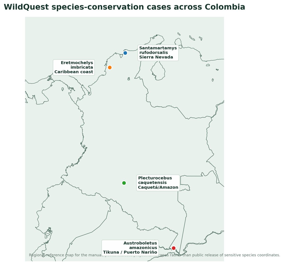
Three additional cases demonstrate transferability. The Plecturocebus caquetensis program uses species and habitat information to protect forest fragments and to organize community conservation. The hawksbill turtle plan for Eretmochelys imbricata uses monitoring and community action around nesting, foraging and trafficking pressures. The Santamartamys rufodorsalis program uses occurrence and landscape information to design ecological corridors and buffer zones in the Sierra Nevada de Santa Marta. Together, the cases show that the same information architecture can serve a fungus, a primate, a marine reptile and a terrestrial small mammal while the conservation response changes according to ecology and territory.
The intended users are therefore wider than app operators. We expect traditional authorities to use the manual to define community rules for field missions. We expect Indigenous youth to use it to operate the mobile workflow. We expect elders and knowledge holders to use it as a bridge between digital observations and territorial knowledge. We expect conservation professionals to use it to convert validated records into maps, restoration priorities and monitoring indicators. The common principle is operational accountability: every field record should have a stated conservation purpose, and every conservation decision should be traceable to field evidence or community knowledge.
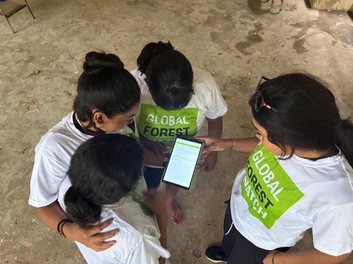
Source basis: WildQuest AI public website, accessed 30 August 2026; Environmental Women ORG field-use adaptation.
2. Tikuna customary operating framework
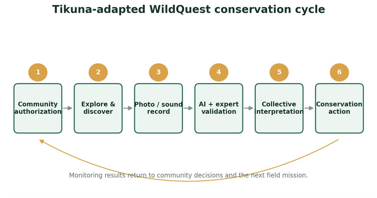
| Role | Primary responsibility in the WildQuest cycle |
|---|---|
| Traditional authority / community conservation body | Authorizes the mission purpose, access conditions and rules for external data sharing. |
| Elders and knowledge holders | Interpret seasonal, ecological and cultural meaning of records without being forced to publish restricted knowledge. |
| Women leaders | Coordinate participation, education and land-use links where these are relevant to the conservation mechanism. |
| Youth / field monitors | Operate the device, maintain the mission log and create consistent georeferenced observations. |
| Expert validators | Confirm or correct species identification before priority records enter the management dataset. |
| Conservation technical team | Turns validated records into GIS analysis, monitoring design, restoration or other measurable responses. |
We begin every WildQuest mission with community authority because the territory already has a system for deciding how knowledge is used. The application enters after that decision. This ordering matters in the Tikuna context. The Ministry of Culture describes Tikuna life plans and Indigenous authority organizations as spaces that reflect community practices, worldviews and problems. We therefore configure field work as a community activity with a defined conservation question rather than as unrestricted data collection. The authority can determine which species are priorities, which routes can be walked, which sites are restricted and which observations can be shared outside the territory.
We organize intergenerational work because a georeferenced observation gains meaning when it is read against lived knowledge. Elders and other knowledge holders can explain seasonal presence, local names, habitat signals and changes that a single photograph cannot show. Youth monitors contribute digital operation and repeated sampling. The relationship is reciprocal. The younger monitor does not replace the knowledge holder with an AI result, and the knowledge holder does not need to operate every digital control. We use the app to create a common object for discussion: a record with a time, place and media file that can be interpreted together.
We assign women a visible operational role because Tikuna women have documented leadership in community processes and in the care and revitalization of the chagra. In this manual, that principle becomes a practical staffing rule. Women can lead mission preparation, manage the observation log, coordinate education activities and participate in validation or decision sessions. A conservation program is more durable when the people who manage food systems, household knowledge and intergenerational learning also participate in the environmental information cycle. This role is particularly important in the Austroboletus amazonicus program because forest use, sustainable harvesting and agroforestry are directly connected to fungus habitat.
We respect language as part of data quality. WildQuest publicly offers Spanish, English and French, while the community protocol can retain Tikuna names and descriptions in the field notes or the parallel community register. Scientific names remain useful because they connect records across institutions. Local names remain useful because they connect records across generations. When the two names are stored together, a young monitor can search the global scientific record without erasing the community's own way of identifying the organism. We recommend that each local species card keep the scientific name, the locally used name and the agreed conservation meaning.
We separate public conservation information from sensitive territorial knowledge. This is especially important for critically endangered species, nesting locations and culturally restricted places. The app can georeference an observation, but the community decides how that coordinate is used. The operational rule is to keep the most precise location inside the authorized conservation team when disclosure could increase poaching, collection or disturbance risk. External maps can show a generalized zone. This practice protects the species while preserving the analytical value of the original record for patrol, restoration and monitoring decisions.
We use collective review to turn records into action. At a periodic community conservation session, monitors present validated observations by species and location. Knowledge holders add context. The authority identifies the required response. The response may be a new monitoring route, a temporary avoidance area, a restoration task or a threat-control action. We then assign a responsible group and record the decision. This creates a closed loop. The following field mission checks whether the decision changed conditions in the site, so monitoring supports adaptive management rather than creating a static archive.
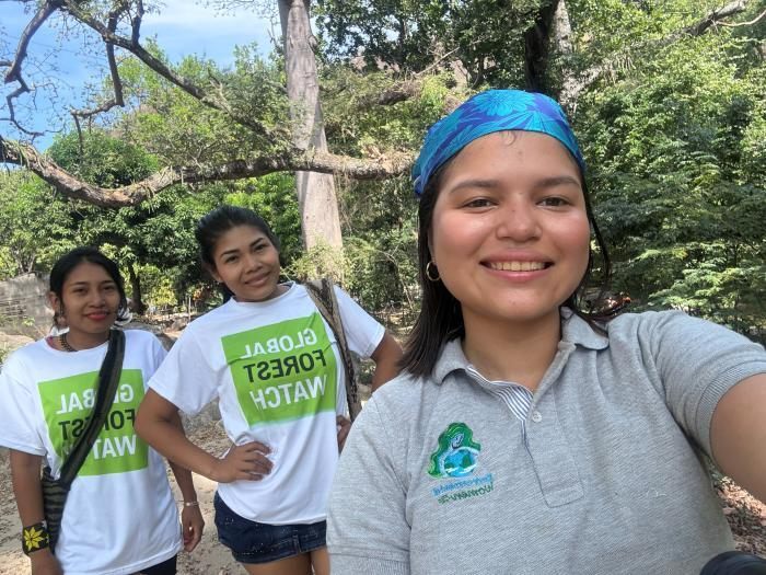
Our Tikuna protocol therefore has six control points: authorization, observation, validation, interpretation, action and feedback. Each control point belongs to a defined actor. The authority controls purpose and access. The monitor controls record quality. The validator controls taxonomic confidence. Knowledge holders control cultural and ecological interpretation. The conservation team controls the technical response. The community controls whether the response remains appropriate. This division of responsibility allows WildQuest to scale without centralizing Indigenous knowledge in the application itself.
This framework is consistent with the logic of our implemented Tikuna conservation work. In the Austroboletus amazonicus program, 300 families are part of the conservation strategy across 9,800 hectares. The program combines protected zones, monitoring stations and restoration. Its educational component reports that knowledge about the fungus increased from 28 percent at baseline to 78 percent after the intervention. That change matters because community conservation depends on the ability to recognize the species, understand its ecological role and respond when habitat conditions change. WildQuest provides the structured observation; customary governance gives the observation a legitimate route into collective action.
Source basis: Tikuna customary context: Ministry of Culture of Colombia; operational adaptation by Environmental Women ORG.
3. WildQuest system architecture: from observation to management
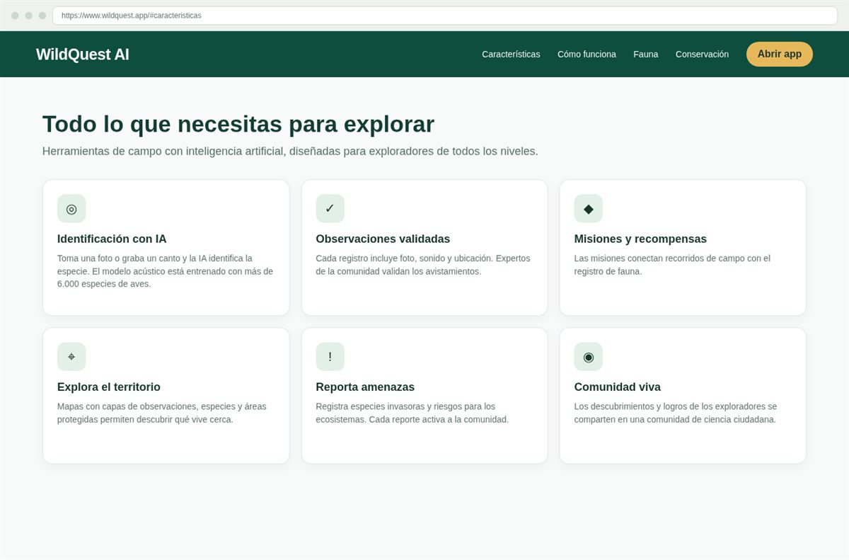
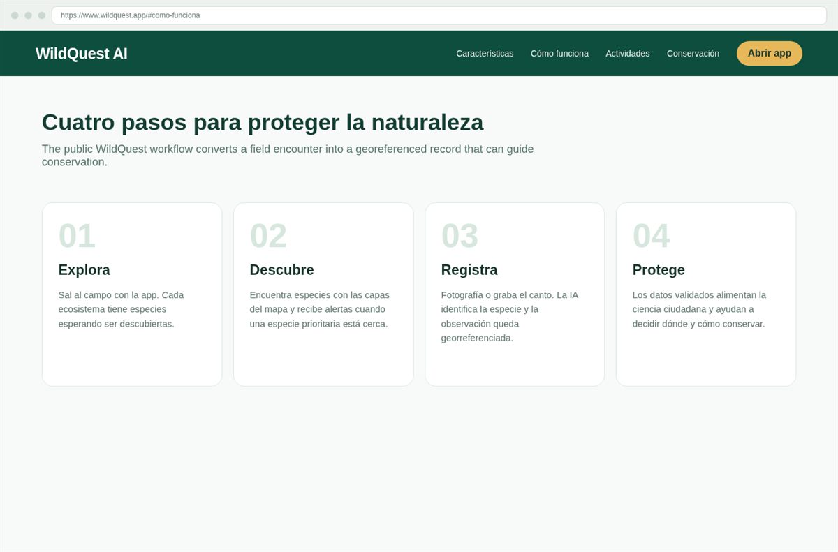
The public WildQuest interface defines a conservation workflow that we can describe as an information chain. The first stage is exploration. The user enters the field with a conservation purpose and can use map layers to understand nearby observations, species and protected areas. The second stage is discovery. The platform can guide attention toward species that are nearby or prioritized. The third stage is registration. The user photographs a species or records a sound, and the observation becomes georeferenced. The fourth stage is protection. Validated records contribute to citizen science and help determine where conservation action is required.
Artificial intelligence reduces the identification barrier at the moment of encounter. WildQuest states that its acoustic model is trained on more than 6,000 bird species. This is important for bird monitoring because the animal may be detected by sound before it is visible. For other taxa, the camera workflow is the main field entry point described by the platform. We treat AI output as a rapid classification aid. The observation becomes stronger when a community expert validates it and when repeated records show a consistent pattern in the same site.
Georeferencing provides the spatial link between a species and a management unit. A location can be compared with a protected-area boundary, a forest fragment, a restoration polygon or a known threat site. This spatial relationship is what converts a biological observation into an engineering input. In the Santamartamys rufodorsalis case, the conservation program uses Geographic Information Systems to evaluate territorial suitability and to locate functional ecological connectors. WildQuest occurrence points can enter that type of analysis because each record has a place attached to it.
Map layers support field planning before the team leaves the community. A monitor can review where previous observations occurred and then select a route that reduces gaps in coverage. We use this function to avoid repeatedly sampling the easiest sites while leaving important habitat unobserved. If the conservation question concerns a priority species, the route should cross its likely habitat and known pressure zones. If the question concerns restoration performance, the route should include both the intervention area and a comparison area. The app does not decide the sampling design; it makes the design operational in the field.
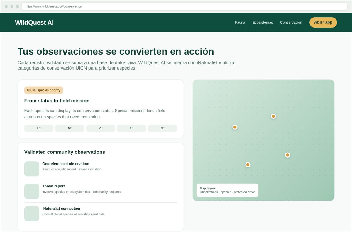
Threat reporting creates a second data stream. A species record says what is present. A threat report says what could reduce that presence. WildQuest publicly describes reporting for invasive species and ecosystem risks. In our programs, the same principle can be applied to habitat clearing, disturbance, illegal extraction or damage to nesting areas when those categories are defined by the conservation team. We keep threat evidence separate from species evidence because each requires a different response, but we analyze the two together to understand cause and effect.
The IUCN status displayed by the platform supports priority setting. WildQuest describes statuses ranging from Least Concern to Critically Endangered and special missions for species that require monitoring. We use the status as one decision variable. Local cultural importance and territorial pressure are additional variables. A species can receive a priority mission because it is globally threatened, because the community has detected a local decline, or because it is a key indicator for a habitat under pressure. This combined rule prevents global categories from replacing local conservation knowledge.
The iNaturalist integration provides an external reference layer. WildQuest states that users can consult observations and species data from that global network. We use external records to add context, while the community field record remains the operational unit for local decisions. This distinction is useful when a species has few local observations. Regional records may suggest where to look, but the local team still needs a verified observation before it changes a patrol route or restoration plan.
The technical architecture can therefore be summarized as Inputs → Validation → Spatial interpretation → Decision → Action → Monitoring. Inputs are photos, sounds, locations and threat reports. Validation increases confidence in identification. Spatial interpretation links records to habitat and management areas. The community and technical team decide what response is appropriate. Field groups implement the response. New observations measure whether conditions changed. This cycle is the core of the manual and the mechanism that allows one platform to support several species-conservation programs.
Source basis: WildQuest AI public website, accessed 30 August 2026; Environmental Women ORG field-use adaptation.
4. Access, language, device preparation and offline readiness
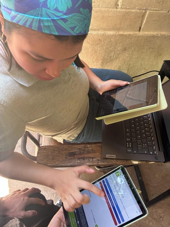
We access WildQuest from the browser at the public application link provided on wildquest.app. The site states that the web app works from a mobile phone or computer without installation. This matters in Indigenous territories because field teams often share devices and may not have access to an app store account. A browser-based workflow reduces the time required to place the tool on a new device. Before the first mission, we open the application while connectivity is available and confirm that the required interface loads correctly.
We choose the working language before training. The public site identifies Spanish, English and French as supported languages. For Tikuna use, we normally keep the interface in the language that the operator reads most confidently and maintain Tikuna names or notes in the community register. This division avoids errors caused by forcing technical labels into a language context where the app does not yet provide a localized interface. The conservation team can later standardize scientific names for reports while preserving the community terminology used in field interpretation.
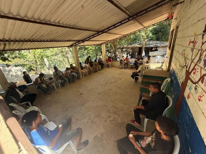
We prepare permissions deliberately. Species records depend on the camera, microphone and location functions described by WildQuest. The operator therefore checks that the browser can use the camera for image records. The operator checks microphone access when the mission includes acoustic observations. Location services must be active when georeferencing is required. We test these permissions before travel because resolving a browser permission problem in the forest can consume battery and field time.
We prepare the device for offline conditions because the public WildQuest page states that the platform can function without connection. The practical objective is continuity of field work when mobile coverage disappears. We charge the device, open the app before leaving coverage and confirm that the mission information needed for the route is available. We also carry a simple paper or offline field log with the observation number, time and local site name. This parallel log allows the team to reconcile records after returning to connectivity and prevents a device problem from erasing the memory of the route.
We manage power as a conservation resource. A phone with a depleted battery cannot record a location or photograph. For a day mission, each team begins with a full charge and a power bank when available. We reduce unnecessary screen brightness and close nonessential applications. The field leader decides when the phone is used for navigation and when it can remain locked. This discipline is especially important in the Amazon because a route can remain outside coverage for many hours and repeated camera use can drain power quickly.
We define a mission identifier before the first record. A simple code can include community, date and route. For example, TIK-PN-2026-08-30-R01 can identify a Tikuna mission in Puerto Nariño on 30 August 2026, route 01. The same identifier appears in the community field sheet. When a species record later generates a restoration or patrol action, we can trace the action back to the mission. Traceability allows us to compare effort across routes and prevents the database from becoming a collection of observations without sampling context.
We agree on sensitive-data rules before enabling location. Critically endangered species, nests and culturally restricted places require controlled disclosure. The full coordinate can remain available to the authorized conservation team, while shared maps use a generalized location. The field operator should know this rule before collecting the record because confidentiality begins at capture. The team should never publish a precise coordinate simply because the device recorded it automatically.
We finish preparation with a two-minute functional test. The operator opens the map, checks location, creates a test photo record and confirms that the app responds. If an acoustic mission is planned, the operator records a short test sound. The field leader checks the mission code and route. The community authority confirms the purpose of the outing. When those steps are complete, the team can enter the field with a shared understanding of what evidence is being collected and why.
Source basis: WildQuest AI public website, accessed 30 August 2026; Environmental Women ORG field-use adaptation.
5. Explore and Discover: planning a conservation route
The Explore function starts with a conservation question. We do not open the map and walk randomly. We first decide what we need to learn. In the Austroboletus amazonicus program, the question may be whether the fungus is present inside a protected zone after restoration. In the Plecturocebus caquetensis program, the question may be whether a forest fragment continues to be used by the primate. In a hawksbill turtle mission, the question may be whether a nesting beach shows current use or a new threat. The route is designed around that question.
We use map layers to understand existing evidence. WildQuest states that its maps can display observations, species and protected areas. We begin with previous observations because they show where the species has already been recorded. We then compare those points with the management unit. A gap can mean that the species has not been observed, or it can mean that nobody sampled the area. The field plan should distinguish those two possibilities. We therefore send teams to both known-use areas and under-sampled habitat when the objective is distribution monitoring.
The Discover function directs attention toward nearby and priority species. WildQuest describes alerts when a priority species is near and special missions for species that science needs to monitor. We use this feature to convert a broad walk into a targeted search. A priority mission has a focal species, a defined habitat and a time window. The monitor still records other relevant observations, but the mission is evaluated against the focal question. This makes effort measurable because we know what the team intended to detect.
We combine digital layers with customary ecological knowledge before finalizing the route. A map may show forest cover, but an elder can identify a seasonally flooded path or a site where a species is usually found after a particular hydrological change. The field leader adds that information to the route without forcing culturally restricted knowledge into the public layer. This approach reduces wasted effort and respects the distinction between knowledge needed for navigation and knowledge appropriate for publication.
We classify routes by risk and conservation value. A route through a known poaching area requires different staffing from a low-risk educational route. A route to a turtle nesting beach may require timing around nesting activity. A fungus monitoring route may require attention to humidity and substrate conditions. We document these operational differences in the mission brief. The application records the biological encounter, while the mission brief records why the team was there and what safety or cultural controls applied.
We use missions and outdoor activities as a structured participation mechanism. WildQuest links missions with walking, trekking, cycling, birdwatching and nature photography. In Tikuna territory, walking and river access can be organized around the actual geography of the community. We do not force an activity category when it does not fit the terrain. The purpose is to connect movement with a consistent observation protocol. A route is successful when the team covers the planned area and produces interpretable records, even if the focal species is not detected.
Non-detection is recorded in the parallel field log because it has conservation value when sampling effort is known. If a historically occupied site produces repeated non-detections under suitable conditions, the conservation team can investigate habitat change or sampling limitations. WildQuest is optimized around observations, so the mission log provides the effort context needed for this interpretation. We connect both sources through the mission identifier.
At the end of the Explore and Discover phase, the team should know three things: where it will go, what it is looking for and what decision the result will inform. The app then becomes a measurement tool within a defined conservation operation. This is the same logic used in our species programs across Colombia. The taxon changes, the landscape changes and the response changes. The planning discipline remains constant.
Source basis: WildQuest AI public website, accessed 30 August 2026; Environmental Women ORG field-use adaptation.
6. Register: creating a conservation-grade field observation
Field data rule: One record should represent one interpretable biological event. Keep species evidence, threat evidence and mission effort linked through the mission identifier, but store them as separate data objects when they answer different management questions.
Registration begins when the organism can be documented without increasing risk to the species. WildQuest allows the user to take a photograph or record a sound and then georeferences the observation. The first field rule is therefore distance before detail. We obtain the best evidence possible without chasing, handling or repeatedly disturbing the organism. A clear record that preserves normal behavior has greater conservation value than a close record created through disturbance.
For a photographic observation, we stabilize the device before capture. The image should show diagnostic features while keeping enough habitat context to interpret the location. For a plant or fungus, one overview image can show substrate and surrounding vegetation. A second image can show the diagnostic structure when that can be obtained without collection. For a mobile animal, we prioritize an image that supports identification and then stop. Repeated pursuit increases stress and can alter the very behavior we are trying to monitor.
For acoustic observation, we reduce handling noise and point the microphone toward the sound source. WildQuest specifically describes an acoustic model trained on more than 6,000 bird species. We therefore use the acoustic workflow most confidently for bird missions. The field team records a segment that contains the focal call and notes any competing noise in the field log. The operator does not need to interpret the entire soundscape at capture. The purpose is to obtain a usable recording that can support identification and later validation.
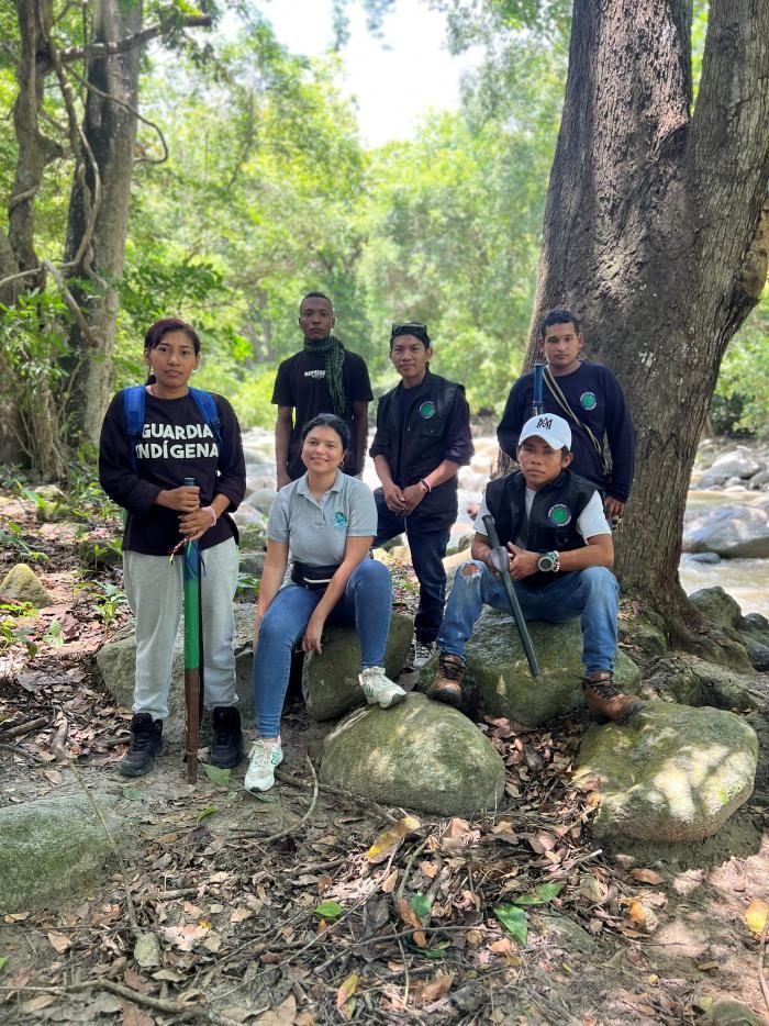
We allow the application to attach location when the mission requires spatial analysis. The coordinate connects the organism to a habitat patch or management zone. We then add the mission identifier and local site name in the accompanying record system. If the point concerns a nesting site, a critically endangered species or a culturally restricted area, we apply the sensitive-location protocol. The precise point remains inside the authorized team. Public communication uses a generalized location that cannot guide an unauthorized collector directly to the site.
We review the AI identification before leaving the observation. The public WildQuest interface describes identification in seconds and can display confidence. We treat confidence as a prompt for field judgment. If the suggested species is consistent with visible characteristics and local knowledge, we keep the record for validation. If it is inconsistent, we capture a better image when that can be done safely or mark the record for expert review. We never reshape the community's observation to match an AI suggestion.
We attach ecological context through a concise field note. The note should answer the management question that the image cannot answer. For example, a fungus record may note whether the substrate is intact or disturbed. A primate record may note whether the group is inside a connected canopy patch or near a cleared edge. A turtle record may note whether the observation is a nesting female, track, juvenile or foraging individual. We avoid long narratives in the record because the structured fields should remain fast to complete in difficult field conditions.
We create a separate threat report when the team observes a pressure. WildQuest publicly includes reporting for invasive species and ecosystem risks. In our conservation protocol, a threat record should have its own location, time, media evidence and short description. The threat should not be hidden inside a species note because that makes later analysis difficult. A separate report allows us to map threat intensity against species presence and to assign a response without losing the biological record.
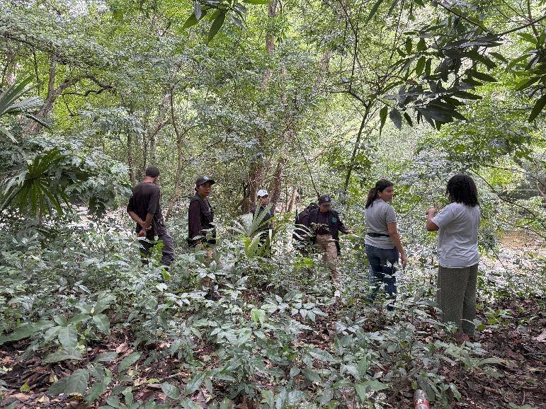
We check the record immediately after capture. The operator verifies that the media file is visible, that the location is plausible and that the species name is saved or flagged for review. The field partner reads the mission code aloud and compares it with the paper or offline log. This 30-second quality-control step is cheaper than returning to the site because a record was incomplete.
We maintain one observation per biological event. If a group of animals is observed at one place and time, we record the event in a consistent way defined by the species protocol. If the team walks two kilometers and sees the same species again in a different habitat unit, that becomes a new observation. Consistency matters because conservation analysis depends on comparable units. The app can hold many records, but the value of the database depends on whether the team uses the same rule across missions.
At the end of the route, the monitor reconciles the digital records with the mission log. Missing numbers are investigated while the route is still fresh in memory. The team flags sensitive records before any sharing session. It then prepares the observations for validation. This handoff marks the transition from field evidence to conservation information.
7. Validate and interpret: combining expert review with Indigenous knowledge
WildQuest states that community experts validate observations. We organize that validation as a distinct step because the conservation consequence can be significant. A record of a common species may support an educational mission. A validated record of a critically endangered species may change a patrol route or habitat protection decision. The validator therefore reviews the media evidence, the proposed identification and the field context before the record enters the priority dataset.
Taxonomic validation and territorial interpretation are different tasks. A biologist or experienced identifier can confirm whether the photograph is consistent with the species. A Tikuna elder or local knowledge holder can explain whether the location, season and habitat use are consistent with community experience. We preserve both contributions. The first controls species identity. The second controls ecological meaning within the territory. The conservation team needs both when it decides whether a new observation represents normal use, range change or a site requiring intervention.
We use repeated observations to strengthen patterns. One record can confirm presence. A series of records can show continued use, seasonal recurrence or response to management. In the Austroboletus amazonicus program, 100 monitoring stations create repeated measurements across protected zones. That structure allows the program to report a 25 percent increase in the presence of the fungus in protected areas after implementation. The lesson for WildQuest is direct: individual observations become impact evidence when they are collected under a repeated monitoring design.
We hold a community interpretation session at an interval appropriate to the conservation program. The session can be weekly during an intensive campaign or monthly during routine monitoring. The technical team presents a map with generalized points if the group includes people who are not authorized to see sensitive coordinates. Knowledge holders describe changes they recognize. The authority decides whether the evidence requires a field response. We document the decision in plain language and link it to the relevant observation identifiers.
We distinguish three validation outcomes. Confirmed records enter the conservation dataset. Uncertain records remain visible for follow-up but do not trigger a high-consequence management action by themselves. Incorrect identifications are corrected while retaining the original media where appropriate for learning. This approach protects the integrity of the dataset without treating mistakes as failure. A community monitoring system improves because participants can see why an identification changed.
We use validation meetings as training. Young monitors learn diagnostic features from real records collected in their territory. Elders can explain habitat associations that are absent from a generic field guide. Women leaders can connect observations to changes in chagra edges, forest use or household resource practices where relevant. The training is therefore tied to actual management questions rather than abstract taxonomy.
We close validation with a conservation status check. WildQuest uses IUCN categories in the species information layer. If the record concerns a globally threatened species, the team marks it for priority review. If the species is locally important despite a lower global threat category, the community can assign its own priority. The local priority does not replace the IUCN category. It adds a territorial management layer that makes the platform useful for Indigenous conservation rather than purely global reporting.
The output of validation is a decision-ready record. It has a species identification with an appropriate confidence level, a controlled location, a mission context and an interpretation of why it matters. At that point, the record can move into the Protect phase.
8. Protect: threat reporting, priority setting and conservation response
| Trigger | Community / technical response | Follow-up indicator |
|---|---|---|
| Validated priority-species record | Define repeat monitoring or expand the priority mission around the habitat unit. | Continued presence, occupancy pattern or habitat condition. |
| Threat report near focal habitat | Community authority assigns patrol, agreement, education, restoration or institutional referral. | Threat frequency or pressure condition on the next monitoring cycle. |
| Repeated records in degraded habitat | Prioritize restoration or habitat-protection action. | Area restored and post-intervention species/habitat response. |
| Occurrence in isolated forest fragment | Run connectivity analysis and review a corridor with the Indigenous authority. | Use of connector / protected linkage and change in fragmentation pressure. |
The Protect phase begins when a validated observation is linked to a management response. WildQuest states that validated data help decide where and how to conserve. We operationalize that statement through a response matrix. The species status indicates urgency. The location indicates the management unit. The threat record indicates the pressure. The community authority indicates what action is legitimate. The technical team then selects a response that can be implemented and measured.
A threatened-species observation can trigger a priority mission. The next mission may revisit the point to confirm continued presence or search the surrounding habitat. If repeated observations form a cluster, the team can define a monitoring zone. If the records occur inside a degraded patch, the conservation program can prioritize restoration. This is the logic documented in the Austroboletus amazonicus program, where 15 protected zones cover 1,500 hectares and 200 hectares were assigned to active restoration.
A threat report triggers a different sequence. The field team documents the pressure and avoids confrontation when a security risk exists. The community authority reviews the report and decides whether the response is a patrol, a community agreement, an educational action or referral to an environmental authority. The app provides the evidence point; the community governance system provides the legitimate response pathway. This separation is especially important in areas affected by illegal extraction or trafficking.
We prioritize habitat connectivity when isolated occurrence points show that a species depends on fragmented forest. The Santamartamys rufodorsalis conservation program provides a technical example. Its GIS method identifies suitable habitat, core forest remnants and connector routes. The design applies a 30-meter buffer to permanent-flow water bodies as reforestation zones and uses 100-meter buffers in corridor design. WildQuest observations can refresh the occurrence layer that feeds this landscape analysis.
We prioritize reproduction sites when the species has a vulnerable life stage. The hawksbill turtle plan identifies nesting and foraging areas as critical. It also documents poaching of nests, capture of adults and juveniles, shell trade, coastal erosion and marine habitat degradation. A validated nesting observation therefore has a clear response: protect the location, organize monitoring and reduce disturbance. The plan explicitly includes volunteer monitoring groups, characterization of priority nesting beaches and community pilot actions around nesting beaches and critical habitats.
We connect conservation with livelihood pressure where the program has identified that causal pathway. The Plecturocebus caquetensis program links forest conservation with community development and alternatives that reduce dependence on forest extraction. It reports ecological stoves that reduce firewood use by up to two-thirds and a protected forest area of 1,304 hectares associated with the conservation effort. WildQuest records help keep the biological outcome visible while livelihood interventions address the pressure that affects habitat.
We measure response with indicators tied to the problem. A monitoring program should not report success only as the number of app users. For a fungus, we can measure presence in protected plots and area restored. For a primate, we can measure occupied fragments and protected habitat. For a turtle, we can measure monitored nesting sites and recorded threats. For a corridor species, we can measure habitat connectivity actions and occurrence within the restored linkage. Digital activity is an implementation metric; ecological change is the result metric.
The Protect phase ends with feedback. After the action is implemented, the team returns to the site under the next monitoring schedule. It records the species, the habitat condition and any remaining threat. The new data are compared with the baseline. If conditions improved, the community can maintain the approach. If conditions did not improve, the response is adjusted. This is adaptive management in operational form, and WildQuest provides the repeated field evidence that keeps the adjustment grounded in the territory.
9. Standard field mission in Tikuna territory: step-by-step SOP
| Mission phase | Minimum control |
|---|---|
| Authorize | A community-defined conservation question and approved route. |
| Prepare | Mission code, device permissions, battery, map and sensitive-data rule. |
| Observe | Low-disturbance photo or sound plus georeferenced record. |
| Log | Observation number, local site context and separate threat record when required. |
| Validate | Expert taxonomic review plus Indigenous ecological interpretation. |
| Act | Named conservation response with responsible actor and follow-up. |
| Return | Repeat monitoring to measure ecological or pressure change. |
A standard WildQuest mission in Tikuna territory begins one day or more before the field route. The traditional authority or designated community conservation body defines the conservation question. The question should be specific enough to guide a route. An example is: confirm the presence of Austroboletus amazonicus in restored forest adjoining Protected Zone 4 and record any current disturbance. The technical coordinator then creates the mission code and prepares the map. A knowledge holder reviews the proposed route and identifies access conditions that the digital map may not show.
The field team normally uses complementary roles rather than assigning every task to one person. One monitor operates WildQuest. A second monitor keeps the mission log and watches for safety or habitat context while the first person photographs. A knowledge holder or trained local guide can lead interpretation where needed. The composition can be adjusted to the community and the risk level. The important requirement is that somebody other than the device operator remains able to observe the site while the screen is in use.
At departure, the team performs the device check. Camera, location and microphone permissions are confirmed. The app is opened while connectivity is available when possible. The route map and priority species information are reviewed. Battery level is recorded. Sensitive-location rules are repeated. The community authority confirms whether any part of the route requires restricted reporting. This five-minute check prevents most avoidable failures during the mission.
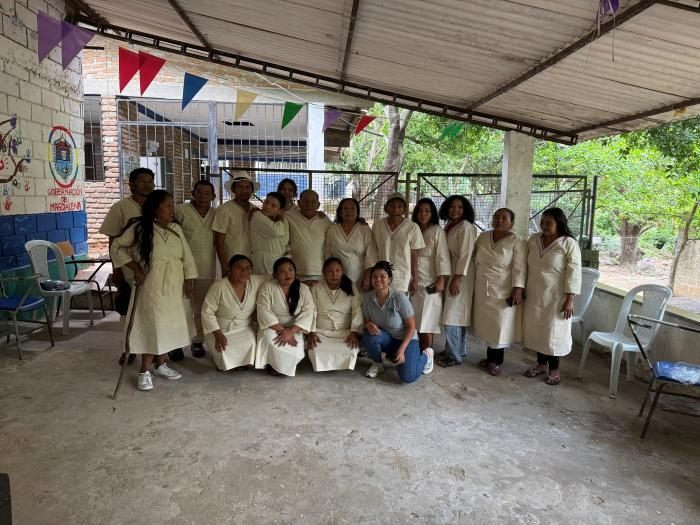
The team begins the route at a known reference point. The log records start time and general weather condition. We do not need a complicated meteorological form unless the species protocol requires it. For fungi, humidity and recent rain may be important. For turtles, tide and night conditions may matter. For a forest mammal, visibility and canopy condition may be more useful. The field variables should match the ecology of the focal species.
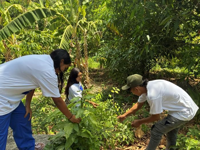
When the focal species is encountered, the operator first assesses whether a record can be obtained without disturbance. The operator then captures the best available photograph or sound. WildQuest attaches location. The operator checks the proposed identification and records the local context. The second monitor writes the observation number in the mission log. If the location is sensitive, the record is flagged immediately. The team then moves on rather than remaining around the organism longer than necessary.
When a threat is encountered, the team records it as a separate event. The description should identify the pressure and its immediate spatial relationship to the habitat. A photograph is taken only when it can be done safely. The team does not confront a suspected offender as part of the data-collection mission. The report is transferred to the community authority after return. This rule keeps conservation monitoring separate from enforcement decisions and protects field participants.
At a planned checkpoint, the team reviews progress against the mission question. If the route has produced repeated records in one easy-access area but has not reached the intended restored patch, the team corrects the sampling bias. If weather makes the remaining route unsafe, the field leader ends the mission and records the reason. A partial mission with documented effort is more useful than an undocumented change to the route.
At return, the field monitor reconciles digital observations with the log. The team identifies records that need expert validation. It then reviews the route with a knowledge holder while the memory of field conditions is fresh. The conservation coordinator prepares a short summary with the number of focal-species observations, the area covered and the threats recorded. These three metrics are sufficient for routine operational control when they are linked to a clear mission purpose.
Within the next review cycle, validators examine the records and the community conservation group interprets them. The group decides whether a site needs a repeat visit, a protection measure or restoration. The decision is linked to the observation numbers. A responsible person and target date are assigned. The next field mission then measures the condition after the response. This is the point at which a phone observation becomes a conservation-management unit.
For training, we use real cases from the territory. The Austroboletus amazonicus program is particularly useful because its implementation has measurable before-and-after indicators. The program reports 100 monitoring stations and 15 protected zones across a 9,800-hectare Tikuna landscape. After two years, it reports a 40 percent reduction in harmful human activities inside protected zones and a 25 percent increase in fungus presence in those areas. A trainee can therefore see the entire sequence from a field record to an area-based conservation outcome.
We finish every mission with a brief learning note. The team records one thing that improved data quality and one operational problem to correct. These notes are reviewed during training. Over time, they refine routes, device preparation and community interpretation. The application can remain technically the same while field practice becomes more efficient. That is how the model scales without losing local control.
10. Implemented case: Austroboletus amazonicus in Tikuna territory
| Implemented measure | Documented scale / result |
|---|---|
| Intervention landscape | 9,800 ha of Tikuna Indigenous territory; 300 families. |
| Protected zones | 15 zones covering 1,500 ha; 40% reduction in harmful human activities reported after two years. |
| Monitoring | 100 stations; 25% increase in fungus presence reported inside protected areas. |
| Active restoration | 200 ha; 30% increase in overall biodiversity reported in the restored area. |
| Community learning | Knowledge increased from 28% at baseline to 78%; 680 people trained. |
| Community participation | 90% of the 300 Tikuna families participated in at least one conservation activity. |
| Ex situ / reintroduction | Spores from 60 mature individuals; 1,200 individuals reintroduced into previously degraded areas. |
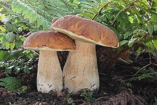
The Austroboletus amazonicus conservation program shows how WildQuest information can support a complete conservation cycle in the Colombian Amazon. The intervention site is 9,800 hectares of Tikuna Indigenous territory associated with Puerto Nariño. The plan identifies the fungus as Critically Endangered and records a baseline of 43 mature individuals. The ecological problem is direct: habitat alteration reduces the humid tropical forest conditions required by the fungus. The social response is also direct because 300 Tikuna families depend on the same forest landscape and participate in its management.
WildQuest contributes at the first control point by creating georeferenced evidence of presence. A field monitor photographs the fruiting body, records the location and links the record to the mission. The identification is validated before it enters the priority dataset. The community then compares the observation with protected-zone boundaries and local knowledge of substrate, moisture and forest use. A record outside a known zone can justify a follow-up survey. Repeated records within a restored area can contribute to the monitoring series.
The conservation program converts those records into area-based management. Fifteen protected zones were established and cover 1,500 hectares. The program also installed 100 monitoring stations. These stations make it possible to revisit fixed locations instead of relying on casual encounters. Two hundred hectares were assigned to active restoration using native species and agroforestry techniques. The WildQuest workflow fits this design because every observation can be linked to a station, protected zone or restoration polygon.
The implementation results show why repeated monitoring matters. After two years, the program reports a 40 percent reduction in human activities considered harmful to the fungus within the protected zones. The monitoring stations recorded a 25 percent increase in the presence of Austroboletus amazonicus in protected areas. The 200 hectares under active restoration showed signs of recovery and a 30 percent increase in overall biodiversity. These indicators measure ecological and pressure change rather than digital activity.
The program also uses ex situ conservation where field evidence shows that in situ protection needs a safeguard. Spores were collected from 60 mature individuals for a spore bank, exceeding the initial target. Three controlled-culture techniques were developed, with 500 individuals in specialized culture. The program reports the reintroduction of 1,200 individuals into previously degraded areas. WildQuest can support reintroduction follow-up by creating standardized georeferenced records at release and monitoring locations without exposing precise sensitive coordinates publicly.
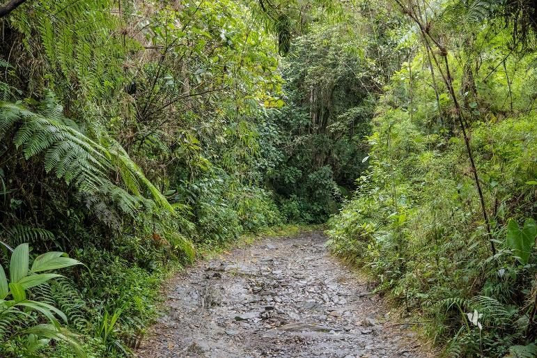
Community knowledge and participation are measured as part of conservation capacity. Initial surveys found that 28 percent of respondents had knowledge about the fungus. After the education intervention, that figure rose to 78 percent. The program trained 680 people and reports that 90 percent of the 300 Tikuna families participated in at least one conservation activity. These indicators matter because protected zones require daily community compliance long after a project workshop ends.
The program links habitat protection with sustainable land use. Twenty pilot agroforestry projects benefited 100 Tikuna families. The program reports a 35 percent increase in income for those families and a 45 percent reduction in deforestation in the intervention areas. This causal link is central to the WildQuest model. Threat records identify where pressure is occurring. Community decisions then address the land-use mechanism that produces the pressure. Monitoring measures whether the habitat response changes.
A practical WildQuest mission in this case can be defined in one sentence: revisit restored and protected forest to confirm fungus presence and record current habitat pressure. The monitor uses the camera workflow because the target is a fungus. The location is attached to the observation. A validator confirms the identification. A knowledge holder interprets the site condition. If the record indicates a new occurrence, the community can consider expanding monitoring. If a threat is recorded near an established occurrence, the authority can strengthen protection or adjust the restoration task.
This case demonstrates scalability because the digital sequence is simple while the conservation package is sophisticated. The app does not need a separate technology for protected-zone management, restoration or agroforestry. It needs to produce consistent records that can be joined to those management systems. The same sequence can then be applied to a different species. That is exactly what our other conservation programs show.
Source basis: Environmental Women ORG, Conservation Plan for the Amazon Fungus 'Austroboletus amazonicus' in the Colombian Amazon Basin.
11. Implemented case: Plecturocebus caquetensis and forest-fragment conservation
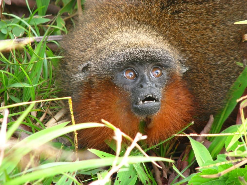
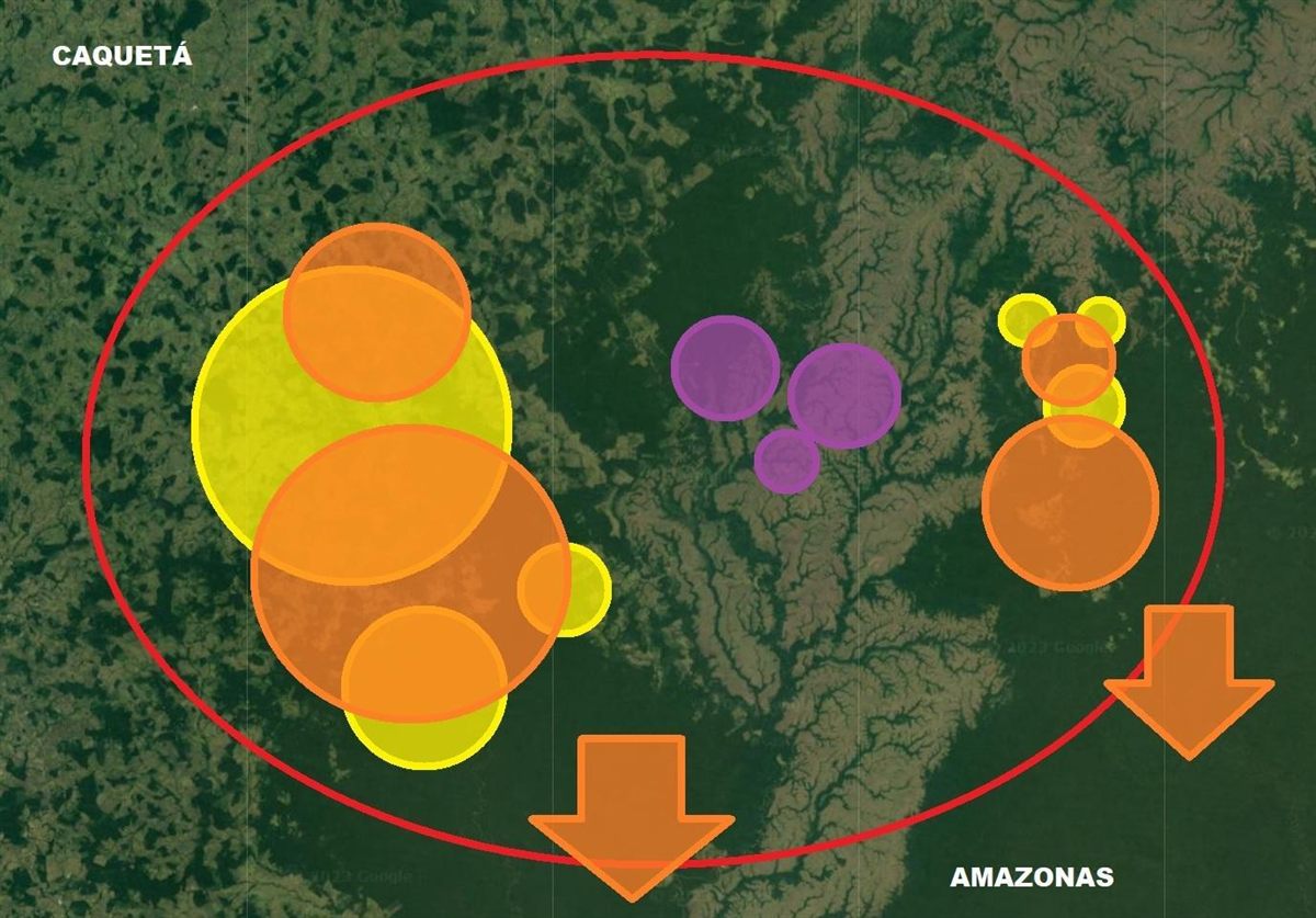
The Plecturocebus caquetensis conservation program uses a different ecological problem: a primate dependent on forest habitat that is under pressure from fragmentation, extraction and wildlife trade. The program combines field research, forest protection, community development and environmental education. For WildQuest, the key operational requirement is to connect a primate observation to the forest fragment in which it occurs. The conservation decision is then made at the habitat scale rather than at the point scale.
The program's field research illustrates the value of systematic coverage. It describes a sampling design based on identified forest fragments and reports 43 fragments surveyed. The resulting model estimated 7,394 individuals in the wild within the forest remaining in the historical distribution area considered by the program. Whether a field team is estimating population or simply confirming occupancy, the lesson remains the same: observation points need a sampling frame. WildQuest provides the georeferenced encounter; the monitoring design defines what that encounter can tell us.
We use the camera workflow for a primate record. The operator photographs the animal or group without pursuing it and allows the application to attach location. The field note identifies the forest fragment and habitat condition. A validator confirms the taxon. During community interpretation, the observation is compared with previous records and with the condition of the canopy connection. A confirmed record in an isolated fragment can support a corridor or protection decision. A repeated absence in a previously used fragment can trigger a targeted habitat assessment.
The program connects scientific information with formal habitat protection. It records support for protected-area processes and concludes with 1,304 hectares of forest protected for the conservation of the focal primate and the species that share its habitat. This is the type of result we want WildQuest to serve. The digital indicator is the number and distribution of validated observations. The conservation indicator is habitat maintained under protection and continued species use of that habitat.
Community development addresses a causal pressure on the forest. The program describes ecological stoves that reduce firewood consumption by up to two-thirds compared with traditional use. It also describes livelihood alternatives designed to reduce dependence on forest extraction. WildQuest threat reports can help identify where extraction pressure remains concentrated. The community can then decide whether a livelihood intervention, patrol or restoration response is most appropriate for that area.
Environmental education completes the feedback loop. The program uses the focal primate as a flagship species to teach the relationship between people, forest and wildlife. Preliminary results described in the program indicate increased knowledge and commitment among students, including commitments related to avoiding capture, purchase or sale of wild animals. WildQuest can make this education local. Students and youth monitors can work with validated observations from their own landscape rather than generic photographs from another region.
A field mission for this case can be framed as an occupancy and threat check. The route crosses a selected forest fragment and its edge. The team records the focal primate where detected and creates separate threat records for clearing, hunting signs or other defined pressures. The community session then asks a practical question: does this fragment still function as habitat, and what action would keep it functional? The answer can be protection, connectivity restoration or pressure reduction.
The case shows how WildQuest supports a conservation program without reducing the program to technology. The app provides a consistent record format and spatial reference. The conservation system provides the sampling design, habitat protection and social response. When those pieces are connected, a species observation can influence land management and community behavior over time.
Source basis: Environmental Women ORG, Amazon titi conservation program / Plecturocebus caquetensis conservation program.
12. Implemented case: Eretmochelys imbricata on the Colombian Atlantic coast
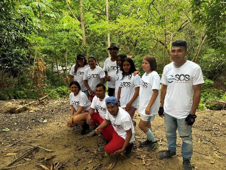
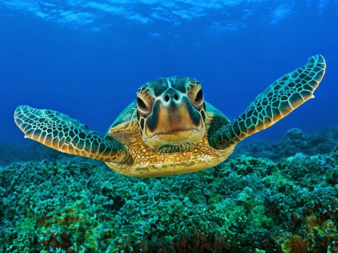
The hawksbill turtle program addresses a marine and coastal species with a vulnerable reproductive cycle. The plan identifies Eretmochelys imbricata as Critically Endangered at national and global levels. It describes nesting across several locations on the Colombian Caribbean and records threats that include nest poaching, capture of juveniles and adults, illegal shell trade, coastal erosion and deterioration of marine habitat. A WildQuest record is therefore most useful when it identifies both the life-stage event and the pressure around the site.
The plan reports that a nesting female can deposit approximately 120 to 180 eggs, with an average of about 140. This reproductive concentration means that a single nesting site can have high conservation value. The field protocol therefore protects location confidentiality. The exact nest coordinate is available only to the authorized monitoring team. Public communication uses a generalized beach sector. This rule reduces the chance that a conservation observation becomes a guide for egg collection or disturbance.
We register different event types separately. A nesting female is one observation. A track without the animal is recorded under the agreed evidence category. A juvenile in a foraging area is a different biological event. A damaged nest or evidence of extraction becomes a threat report. This separation allows the conservation coordinator to calculate nesting activity independently from threat frequency and then compare the two spatially.
The hawksbill plan includes continuous population monitoring and the organization of volunteer groups. It calls for characterization of prioritized nesting beaches and seasonal reports. WildQuest can standardize those volunteer observations because each record carries media and location. Expert validation then reduces misidentification. The mission identifier provides effort context, which is needed when comparing one nesting season with another.
The plan also includes education and community awareness. Information boards on nesting beaches and participatory education are part of the intervention logic. WildQuest can support these actions by providing current, locally collected examples. A community educator can show a generalized map of validated observations and explain why certain beach sectors have restricted access. The conservation message becomes causal: the species nests here, this pressure affects the nest, and this community rule reduces the pressure.
Habitat management extends beyond the nest. The plan identifies feeding areas and coral-reef condition as relevant to the species. It calls for coastal restoration using native vegetation as a response to erosion and warming pressures around nesting areas. A threat-reporting workflow can document erosion points, plastic accumulation or habitat disturbance. These records can then be used to prioritize restoration or clean-up activities that have a direct relationship with the turtle's use of the coast.
A standard WildQuest mission in this case begins with a beach sector and monitoring window authorized by the local conservation group. The team follows the agreed route, records turtle evidence, and creates separate threat reports. The exact coordinates remain controlled. After validation, the community group reviews the map and assigns patrol, education or restoration actions. The following monitoring round checks whether threats changed and whether the site continues to be used.
This case demonstrates that the WildQuest model works in a landscape where movement is linear and seasonal rather than forest-patch based. The same core functions remain useful: georeferenced observation, validation, conservation status, priority missions and threat reporting. The conservation response changes because turtle ecology changes. That adaptability is a central reason the platform can support species programs across Colombia.
Source basis: Environmental Women ORG, Action Plan for the Conservation of the Hawksbill Turtle on the Colombian Atlantic Coast.
13. Implemented case: Santamartamys rufodorsalis and ecological connectivity in the Sierra Nevada
| Spatial design element | Operational rule in the conservation plan |
|---|---|
| Core forest remnants | Selected as habitat nodes; approximately ≥1 ha used as a reference threshold in the small-mammal analysis. |
| Permanent-flow water bodies | 30 m buffer used as reforestation / natural-connector zone. |
| Designed corridor route | 100 m buffer applied on each side of selected routes. |
| WildQuest contribution | Validated georeferenced occurrence points refresh the evidence used to prioritize connectivity and monitoring. |
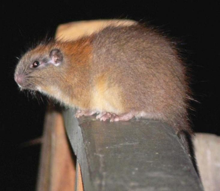
The Santamartamys rufodorsalis program in the Sierra Nevada de Santa Marta addresses habitat fragmentation through ecological corridors and buffer zones. In our wider conservation work, the Sierra Nevada case is implemented with Indigenous participation, including the Narakajmanta community context identified for this manual. The technical mechanism is landscape connectivity. A WildQuest occurrence point becomes useful when it is combined with forest cover, water, access and other spatial variables that determine whether habitat patches can remain connected.
The program uses Geographic Information Systems to identify areas with higher territorial suitability for the target species and to locate functional connectors. Its method begins with forest cover and habitat criteria, creates spatial layers and then combines them to classify suitability. The document explicitly states that the methodology can be adjusted for other species. WildQuest strengthens this type of model because new occurrence records can update where the species is known to use the landscape.
Core forest remnants are selected as nodes for connectivity. The program uses a reference minimum remnant of approximately one hectare for the small-mammal habitat analysis. Permanent-flow water bodies receive a 30-meter buffer that can function as a reforestation zone and natural connector. Where natural connectors are insufficient, the GIS design traces corridor routes through areas with better territorial conditions. A 100-meter buffer is applied on each side of selected routes in the corridor design.
The field workflow begins with occurrence confirmation. A Narakajmanta monitor photographs the species where possible and records the georeferenced observation. The observation is validated before entering the habitat model. The conservation team then checks whether the point falls inside a core area, a proposed corridor or an isolated fragment. If the point is in an isolated fragment with suitable habitat between nodes, it strengthens the case for connectivity action.
Threat reports add the pressure layer. The plan identifies deforestation, habitat fragmentation and hunting as important problems in the broader conservation logic. A field team can record clearing, edge disturbance or other agreed pressures separately from the species observation. The GIS team then overlays occurrence and threat data. This allows a corridor to be prioritized because it connects occupied habitat while also addressing a pressure that could break that connection.
The community interpretation step is essential because a mathematically efficient corridor may cross an area with a different local use or cultural meaning. The map therefore returns to the Indigenous authority before field implementation. Knowledge holders can identify natural movement routes, water conditions or restrictions that are absent from the spatial dataset. The corridor design is adjusted where necessary. This sequence keeps GIS as a decision-support tool rather than an external land-use command.
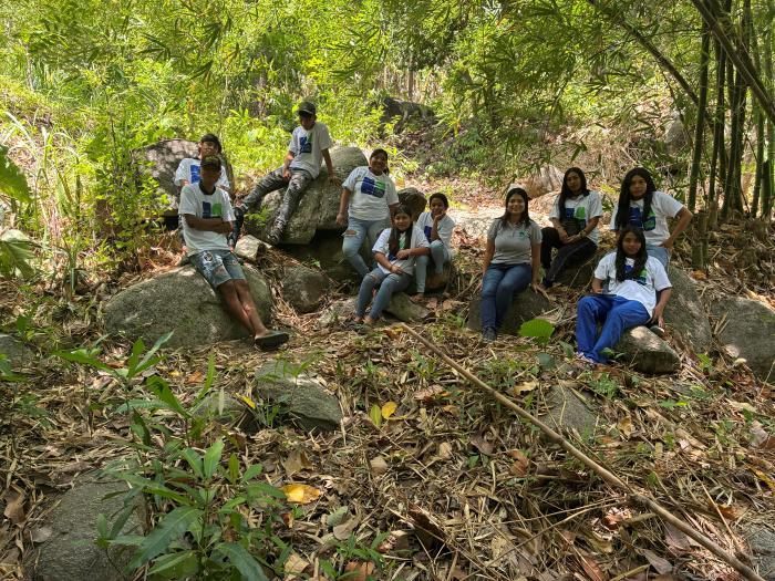
After a connector is restored or protected, WildQuest provides a practical monitoring method. The field team repeats routes through the corridor and adjoining nodes. New validated observations indicate whether the species continues to use the landscape connection. Threat reports show whether disturbance is increasing or decreasing. Vegetation monitoring can be maintained in the restoration system. Together, those indicators allow the community to determine whether the corridor is functioning and where maintenance is required.
This case is particularly valuable for scaling because it demonstrates a bridge between citizen-science records and formal spatial planning. The application handles the observation. GIS converts multiple observations into a landscape hypothesis. Community governance determines whether the proposed intervention fits the territory. Restoration or protection implements the decision. Repeated monitoring tests the result. That is a complete engineering sequence for community-based species conservation.
Source basis: Environmental Women ORG, Santamartamys rufodorsalis ecological corridors and buffer zones proposal / implementation framework.
14. Replication, monitoring and knowledge governance across Colombia
| Monitoring level | Core question | Example indicator |
|---|---|---|
| Effort | Did we sample the intended landscape? | Missions completed; area or route covered. |
| Data quality | Can the records support a decision? | Validated focal-species observations; usable threat reports. |
| Management response | Did the evidence change management? | Protected hectares, restoration actions, patrol or community decisions linked to records. |
| Ecological result | Did species or habitat conditions change? | Presence trend, habitat condition or threat reduction over time. |
The four cases demonstrate replication because the same information process operates across different taxonomic groups and landscapes. Austroboletus amazonicus is a fungus in humid Amazon forest. Plecturocebus caquetensis is a forest primate. Eretmochelys imbricata is a marine reptile that depends on nesting and foraging habitat. Santamartamys rufodorsalis is a terrestrial small mammal used in a connectivity model. WildQuest does not require these species to share ecology. It requires each program to define what a valid record means and what conservation decision follows from it.
We scale out by adding communities and species to the same operating protocol. A new community begins with authorization, defines its priority species, configures its field missions and trains monitors. The digital workflow remains recognizable, which reduces training costs. The local conservation rules change because the community chooses its own restricted sites, local names and response mechanisms. This combination gives us standardization where it improves efficiency and adaptation where it protects Indigenous governance.
We scale up by connecting validated records to institutions that can act on them. The public WildQuest platform already describes iNaturalist integration and protected-area layers. Our conservation programs add community authorities, universities and environmental institutions when their role is needed. The information product should match the decision level. A community patrol needs a precise local map. A regional conservation report may need aggregated observations and hectares. A national or international knowledge product may need trends without sensitive coordinates.
We scale deep by strengthening the way conservation knowledge is transmitted inside the community. A youth monitor learns to create a georeferenced record. An elder explains why the species appears in that habitat or season. A woman leader can connect the observation to land-use practice and community education. Repeated review sessions turn the app into a shared learning tool rather than an individual device. This intergenerational process is particularly compatible with the Ministry of Culture's documentation of elders as carriers of memory and with Tikuna participation in community life plans.
Our monitoring framework separates four levels. The first is effort: missions completed and area covered. The second is data quality: validated observations and usable threat reports. The third is management response: protected hectares, restoration actions or patrol decisions linked to records. The fourth is ecological change: species presence, habitat condition or threat reduction over time. We report all four because a project can have high digital activity while producing little ecological change. The Austroboletus case demonstrates the full chain with documented pressure reduction and increased species presence.
Knowledge governance controls who can access each level of data. Public species information can be widely shared. Sensitive occurrence coordinates remain restricted. Cultural knowledge that the community does not authorize for external use stays outside the public system. Aggregated results can still demonstrate conservation impact. For example, a report can state that 15 protected zones cover 1,500 hectares without exposing the precise location of every Critically Endangered fungus record.
We maintain a simple indicator dashboard for each species program. The dashboard names the baseline, current value, target and evidence source. The evidence source can be WildQuest observations, a GIS layer, a patrol log or a community decision record. This makes the system auditable without placing every type of evidence inside the application. WildQuest remains the biodiversity observation layer within a wider conservation-management architecture.
The result is a model that can be explained clearly to an external evaluator: we collect standardized biodiversity evidence, keep control of sensitive Indigenous knowledge, convert validated records into local management decisions and measure the ecological response. The model has already been used to support species-specific conservation work in several Colombian regions. Scaling therefore means increasing the number of communities and landscapes that can operate this cycle while preserving local authority over the conservation response.
15. Quick-reference field guide and troubleshooting
30-second field check: Record visible? Location plausible? Mission code linked? Threat stored separately? Sensitive coordinate flagged? If yes, move on and reduce disturbance.
| Problem | Immediate field response |
|---|---|
| AI suggestion looks wrong | Keep the media file; capture a better view only if safe; flag the record for expert validation. |
| Location missing | Record local site name and route position in the mission log for later reconciliation. |
| No connectivity | Continue under the offline mission protocol and synchronize when connectivity returns. |
| Device power low | Prioritize focal-species and threat records; reduce screen use; switch to backup log if needed. |
| Sensitive species / nest | Restrict the exact coordinate before any sharing or public map export. |
| Immediate threat / security concern | Leave safely, preserve evidence already obtained and transfer the report to the community authority. |
The quick-reference rule is: Purpose before record, quality before quantity, community decision before external sharing. A field monitor should be able to explain the conservation question before opening the camera. A validator should be able to explain why the identification is accepted. A community authority should be able to explain what action follows from the record. When those three conditions are met, WildQuest is functioning as a conservation system rather than as a species-photo archive.
Before departure, we confirm the mission code, route, focal species and sensitive-data rule. We check camera, microphone when needed, location and battery. We open the app while connectivity is available and review the map. The field log is ready as a backup. The community authority has approved the purpose. This preparation should take minutes because the decisions were made during mission planning.
During capture, we avoid disturbance. We obtain one usable biological record and then move away. We record the threat separately if a pressure is present. We check that the location is plausible and the media file is attached. We record the observation number in the field log. Sensitive records are flagged immediately. These steps protect both data quality and the species.
If the AI suggestion appears inconsistent with the organism, we keep the media evidence and send the record for expert validation. We do not force a match. If the location is missing, we record the local site name and mission position in the field log so that the observation can be reconciled later. If the app is offline, we continue under the mission protocol and synchronize when connectivity returns. If the device fails completely, the field log preserves the event for a repeat visit or later manual entry under the team's agreed procedure.
If a record concerns a Critically Endangered species or a nest, we apply location control before sharing. The exact coordinate remains with the authorized conservation team. If the record shows an immediate threat, the monitor reports it to the community authority after leaving the site safely. The field team does not convert a monitoring mission into an enforcement confrontation. This separation protects Indigenous monitors and maintains a clear chain of responsibility.
At return, we reconcile records, validate priority observations and prepare the community review. The review should end with a decision or a documented reason why no action is needed. A decision has a responsible actor and a monitoring follow-up. The next mission checks the site. This final step is what creates adaptive management.
For training, we use the four implemented cases in this manual. The fungus case teaches fixed-station monitoring and restoration. The primate case teaches fragment occupancy and habitat protection. The turtle case teaches sensitive reproductive locations and threat control. The small-mammal case teaches connectivity planning. A new monitor can therefore learn the same WildQuest controls through four different conservation problems and understand that the application serves the ecology of the species rather than imposing one universal intervention.
For reporting, we use figures that demonstrate scale or change. Examples include hectares protected, monitoring stations operating, presence change, threat reduction and trained community participants. We avoid decorative numbers. In the Austroboletus program, 1,500 hectares protected and a 40 percent reduction in harmful activities describe management performance. A 25 percent increase in fungus presence describes ecological response. Those are the types of metrics that should accompany WildQuest records when the program is presented to a conservation funder or academic evaluator.
The field manual should be updated when the platform adds functions or when the community changes its conservation protocol. Version changes should preserve the six control points used throughout this document: authorization, observation, validation, interpretation, action and feedback. Keeping that backbone stable allows the technology to evolve without weakening the community conservation system.
References and source basis
- WildQuest AI. Public website and application information pages: Features, How It Works, Activities, Fauna, Ecosystems and Conservation. https://www.wildquest.app/. Accessed 30 August 2026.
- Ministerio de Cultura de Colombia, Dirección de Poblaciones. Caracterizaciones de los Pueblos Indígenas de Colombia: Pueblo Tikuna. Source used for community organization, participation spaces, life plans and women's leadership context.
- Ministerio de Cultura de Colombia. Palabra Dulce – Amazonas. Source used for intergenerational transmission and the role of elders in Indigenous language and memory in the Amazonas context.
- Environmental Women ORG. Conservation Plan for the Amazon Fungus Austroboletus amazonicus in the Colombian Amazon Basin. Project archive. Used for 9,800-ha intervention scale, 300 Tikuna families, protected zones, monitoring, restoration and documented implementation results.
- Environmental Women ORG. Conservation Program 2022–2032 of the Caquetá Tití Monkey (Plecturocebus caquetensis) in the Colombian Amazon Basin. Project archive. Used for forest-fragment monitoring, population work, habitat protection and community conservation mechanisms.
- Environmental Women ORG. Action Plan for the Conservation of the Hawksbill Turtle (Eretmochelys imbricata) on the Colombian Atlantic Coast. Project archive. Used for species status, nesting ecology, threats, community monitoring and habitat-management actions.
- Rodríguez, N. / Environmental Women ORG. Proposal for Ecological Corridors and Buffer Zones as Measures to Restore Connectivity of the Habitat of Santamartamys rufodorsalis in Colombia. Project archive. Used for GIS suitability analysis, ecological corridor logic and buffer design.
- GEF SGP CSO Innovation Challenge Program. Call for Proposals 2026 and Guidelines for Applicants for the Concept Note Phase. Used as the external conservation-scaling context for the manual's emphasis on proven models, replication and measurable environmental results.